Trail Running in the Smoky Mountains
Several years ago I was lucky enough to lose a loosely tied shoe in ankle deep mud at Dances with Dirt - Gnawbone. This predicament gave me pause to not only laugh at myself (an important ultrarunning skill) as I felt the mud squishing up through my sock on my now shoeless foot, but also to share a few casual words with another ultrarunner. Since then, he and I have become good friends, sharing several stupidly fun training runs as well as the sweet victory that is accompanied by finishing your first 100 mile foot race.
So when Jason invited me to come along on vacation with his family, I knew it would be an adventure. After a fairly mundane car ride during which the highlight was listening to the hunger games on mp3, we arrived in Pigeon Forge, TN. All I can say about that city is wow. I think it exemplifies the modern human condition, one in which we are engrossed in overconsumption, and overindulgence, when there is a huge National park just miles away and indicates how much we have lost touch with our natural origins. Looming tourist attraction litter the strip and the traffic is nearly unbearable. OK, I also think its designed to entertain kids. I will stop my rant here, because that is not the focus of this post.
Our cabin in Gatlinburg was cozy, but felt like it had plenty roomy for the 10 of us, unless we were all trying to be in the kitchen at one time :) So thanks Arden for picking such a winner. Once we arrived in Gatlinburg, Jason and I set out to aquire every piece of information we could find on hiking, trails, and waterfalls in the area. This was best accomplished at the National Park visitors center (suprise suprise) where I bought a very nice book that contained a short snippet about every trail in the park, as well as the elevation change, elevation profile, and possible dangers on that trail. Trail maps were a dollar, and very helpful so we bought 4 of those as well.
 |
| Day 1 run along the TN-NC border via the AT |

Eager to begin our adventure, Jason and I set out at 7am Sunday morning with full packs, extra water bottles and a load of snacks. We planned a run that started at the Chimney tops trailhead, connected to the Road Prong Trail, then dumped out onto the Appalachian Trail. After passing Newfound gap, we continued on the AT until it it met the Boulevard trail. We ran (hiked? grunted? staggered?) the Boulevard trail up around the backside of Mt. LeConte, and hit the summit of LeConte which is just a touch over 6,500 feet. We stopped here, took in the sights, snapped a few pictures, and checked out the lodging that the park service maintains near the summit. It was here we found fresh water, and another ultrarunner, who was visiting from Oregon. He suggests some other trails that were near the summit and we took these into account when planning later paths. The guy was clearly an experienced runner, and after a brief conversation, he turned out to be the type of runner I admire, someone who has been doing this forever, and just never gets tired of it.
 |
| Boulevard trail which let us run along the ridgeline for quite a ways |
 |
| 5,496 feet of ascent over 19.8 miles. In 5 hours. |
Legs were a little sore the next morning from all the downhill, but bearable - so we headed out with Jason's wife, Arden, and his mom, Vickie for an adventure along the AT. Our goal was to start at the trailhead where the Road Prong Trail met the AT and continue down the AT towards Clingmans Dome. We agreed to go out for 90 minutes then turn around so that we got in roughly 3 hours. We ended up stopping a little short of clingmans dome, before we had reached the summit, but we had already been gone for longer than our allotted time. Almost the entire run was done in the clouds as we had some low lying clouds that had settled onto the AT, which made it slightly surreal.
 |
| Jason wanted the ladies to take a picture with the tree stump |
 |
| A "mere" 2,200 feet of ascent in 3:30 hours (9 miles) |
 Our last big run in the mountains was a fantastic combination of scenery, climbing, and exploration. We set out at the heavily used Rainbow falls trailhead, but at 7am it was nearly empty. From there we had a gradual (mostly) but sustained climb up Trillium Gap trail. We stopped for pictures at Groto falls, where the trail actually runs behind the waterfall, and then pushed on to Trillium Gap. We were planning on taking the Brushy Mtn. Trail to the point where it connected with Porter's creek Trail, but Jason suggested with quickly summit Brushy Mtn. A great idea, and a quick push led us up to a treeless summit that had a fantastic view. We ran back down Brushy Mtn and took the Brushy mtn. Trail down, down, down, until we reached Porter's Flat, then turned around and went up, up, up. This was probably one of my favorite parts of the day. the Brushy Mtn. Trail seemed to have been used very little, we saw no one, very few footprints, and some bear droppings.
  |
| Brushy Mtn summit with Mt. LeConte in the background |
Somewhere along the climb up Brushy Mtn Trail I ran out of water. Jason had packed Iodine pills, so I filled a bottle at a small waterfall that went across the trail. Never done that before. Waited 30 minutes for the iodine to work, and then the water didnt taste too bad. I still have my fingers crossed, hoping that I dont get Giardia. Once we were back at the junction of Trillium Gap and Brushy Mountain trails, we turned South and headed up Mt. LeConte for the second time in 3 days. This summit proved to be a little bit steeper than the path we had taken up Boulevard, which was gradual along the ridgeline. It was a joy. Somewhere along the way I started hurting pretty bad and had to tuck in behind Jason and just stare at his feet as we continued up.
Just as we reached the top of Leconte, we heard thunder and a quick glance at the sky showed dark clouds moving in. Lucky for us we had been at the Leconte camp a few days earlier and quickly found water and the trailhead that would lead us back down the mountain. We descended down Bullhead trail, which also had some spectacular views, but moved quickly and didnt stop for pictures. There were the usual small stream crossings on the trails and the changing flora as we changed altitude. We both managed our calories, hydration and salt well and finished the downhill with grins on our faces. Funny, right as we got to the car, it started pouring rain. I guess we planned that run out just right.
Just as we reached the top of Leconte, we heard thunder and a quick glance at the sky showed dark clouds moving in. Lucky for us we had been at the Leconte camp a few days earlier and quickly found water and the trailhead that would lead us back down the mountain. We descended down Bullhead trail, which also had some spectacular views, but moved quickly and didnt stop for pictures. There were the usual small stream crossings on the trails and the changing flora as we changed altitude. We both managed our calories, hydration and salt well and finished the downhill with grins on our faces. Funny, right as we got to the car, it started pouring rain. I guess we planned that run out just right.
 |
| We dreamed this one up after quite a few beers... |
 |
| Trillium gap --> Summit Brushy Mtn --> Brushy Mtn Trail to Porters flat and back to Trillium Gap --> Summit Leconte and Descent via Bullhead trail |
I was a little taken back when I plugged my Garmin in and saw that our run had 7,600 feet of climbing. That is easily the most ascent I have ever had in such a short amount of time. The trails were extremely challenging, I can see why Masseneuten and Grindstone are advertised as being as tough as they are; tons of climbing and challenging footing can really beat you into the ground if you dont keep fueling properly and have a positive attitude. These running adventures have made me strongly consider signing up for Grindstone, we will see.
This was such an awesome trip, I am definitely planning on going back (already looking into it). Cades Cove looks like it has some amazing trails, maybe terrain that is slightly more runnable too. Looking back, I am left with a sense of longing, knowing that I cannot find anything to match this kind of running that is close to my home. But with a busy race/travel schedule I should keep myself fairly occupied.
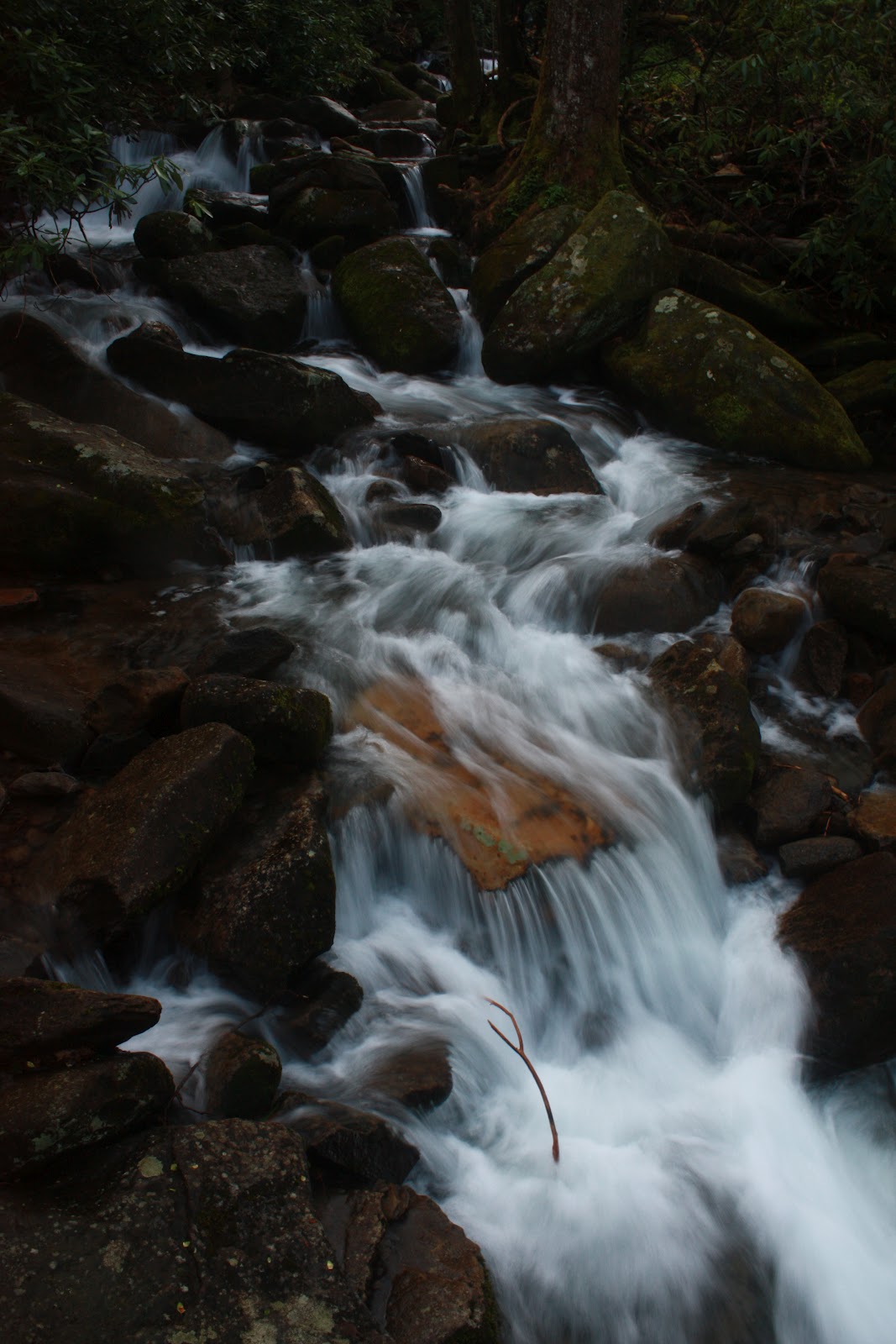
Some more pictures from the trip (using a DSLR while hiking).


This was such an awesome trip, I am definitely planning on going back (already looking into it). Cades Cove looks like it has some amazing trails, maybe terrain that is slightly more runnable too. Looking back, I am left with a sense of longing, knowing that I cannot find anything to match this kind of running that is close to my home. But with a busy race/travel schedule I should keep myself fairly occupied.
Some more pictures from the trip (using a DSLR while hiking).


Thanks for the report. I have hiked those same trails you were on. They are beautiful. I love people that live life. Keep on running.
ReplyDeleteI live very close to the Smoky Mountains, but for some reason haven't hiked (or attempted to run) any of the trails. Reading this gives me a bit of inspiration and quite a new perspective, since I'm reading something from an outsider's point of view! Thank you for the blog post!
ReplyDelete